Int'l : +1-503-894-6022 | Toll Free : +1-800-792-5285 | help@alliedmarketresearch.com
A07232 | Pages: 281 | Charts: 70 | Tables: 148 |
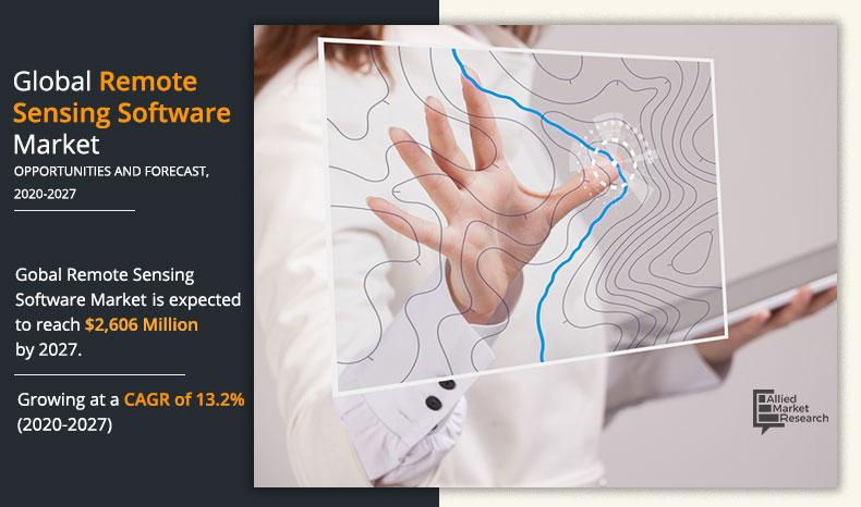
The global remote sensing software market size was valued at $ 976 million in 2019, and is projected to reach at $ 2,606 million by 2027, growing at a CAGR of 13.2% from 2020 to 2027. The remote sensing software is a software solution or platform which processes the remotely sensed data or information about properties of the areas including the land, sea, and atmosphere with the help of remote sensors located at some distance from the target. These software are similar to graphics software which enables generation of geographic information from airborne, ground based, and satellite sensor data. Its applications include weather forecasting, land-use mapping, natural hazards study, environmental study, and resource exploration. Data obtained through remote sensing software is typically stored & manipulated with computers.
[COVIDIMPACTSTATEMENT]
The software segment dominated global remote sensing software market in 2019, and is expected to maintain this trend during the forecast period, due to the rising need in geographic imaging to process vast amounts of geospatial data every single day. These software are saving both the time as well as money, leveraging the existing data investments, and improving image analysis capabilities, with just a single software application. However, the services segment is expected to witness the highest growth, owing to the growing need for remote sensing and mapping consultancy, as well as GPS satellite surveying and positioning services in the numerous industries.
Get more information on this report : Request Sample Pages
On the basis of software type, the web-based segment exhibited the highest growth in the remote sensing software market in 2019, and is expected to maintain its dominance in the upcoming years, owing to the growing need to develop an inexpensive, easy-to-use set of analytical tools for viewing remotely sensed imagery and accessing GIS data. Web-based management and analysis applications are a witnessing significant adoption due to its ability to resolve various limitations relating to the costs of installing GIS and image processing software packages. However, the mobile based segment is expected to witness highest growth during the forecast period, as the ability of the smartphone based remote sensing software to easily and quickly collect the ground level measurements is leading to the huge adoption of remote sensing software for various earth monitoring & research applications.
[COMPONENTGRAPH]
Get more information on this report : Request Sample Pages
By end user, the global remote sensing software market share was dominated by the government & defense segment in 2019 and is expected to maintain its dominance in the upcoming years, owing to growing demand for accessing accurate high-resolution imagery and the ability to deliver the information within rapid timelines is observed across various national security agencies and homeland security departments. However, the commercial segment is expected to witness highest growth during the forecast period due to the ongoing adoption of remote sensing software to improve agricultural yields by measuring soil moisture and crop growth; locate sub-surface commodities such as natural gas & oil; and aid environmentalists in detecting ground, air, and water pollution.
[DEPLOYMENTMODEGRAPH]
Get more information on this report : Request Sample Pages
North America dominates the remote sensing software market, owing to rapidly growing need to address academic and applied archaeological as well as anthropological research problems using the innovative archaeological remote sensing solutions. In addition to this, the recent advances in satellite-based remote sensing are providing new growth opportunities for the market in North America for insurance design and predictive analytics. However, Asia-Pacific region is expected to observe highest growth rate during the remote sensing software market forecast period as the rapid population growth, urban development, poverty, deforestation, and land degradation in this region is causing degradation of natural resources and deterioration of environmental quality which is leading to the need of reliable & timely information for sustainable management of natural resources as well as for environmental protection. Moreover, China and India are representing huge population along with the fast-growing economies and relatively low level of geospatial technologies adoption at present; hence, generating numerous opportunities for the remote sensing software market.
[APPLICATIONGRAPH]
Get more information on this report : Request Sample Pages
The report focuses on the growth prospects, restraints, and remote sensing software market analysis. The study provides Porter’s five forces analysis of the remote sensing industry to understand the impact of various factors such as bargaining power of suppliers, competitive intensity of competitors, threat of new entrants, threat of substitutes, and bargaining power of buyers on the remote sensing software market trends.
The remote sensing software market is segmented on the basis of component, deployment model, software type, application, end user, and region. On the basis of component, it is categorized into software and services. On the basis of deployment model, it is classified into on-premise and cloud. By software type, it is bifurcated into web-based and mobile. Depending on application, it is divided into ground, airborne, and satellite. By end user, the market is classified as defense (defense organizations and homeland security agencies) and commercial (energy & power, agriculture, healthcare, scientific research, weather forecasting, education, and others. Region wise, it is analyzed across North America, Europe, Asia-Pacific, and LAMEA.
[REGIONGRAPH]
Get more information on this report : Request Sample Pages
The COVID-19 pandemic has brought radical changes to daily lives of the people, work, and the surrounding environment. Investigators are adopting remote sensing software solutions for helping decision makers to implement policies on economic loss assessments, resilience of the environment, city reopening, and arrangement of medical resources. The remote sensing market is projected to prosper during the COVID-19 pandemic as well as in the upcoming years post pandemic. For instance, in March 2020, to help public health agencies as well as other organizations initiate their response, Esri announced to provide the ArcGIS Hub Coronavirus Response template with the complimentary six-month ArcGIS Online subscription for ArcGIS Hub. ArcGIS Hub is a framework that is used for building the website to analyze and visualize the crisis in the context of population and assets of community or organization.
The global remote sensing software market growth is driven by factors such as increase in advancements in the remote sensing technologies, rise in need of remote sensing data in various defense applications, and growing adoption of GIS applications for environmental risk management. Growing investments in satellite communication and Intelligence, Surveillance, and Reconnaissance (ISR) payloads is expected to further drive the growth of the remote sensing software market in the upcoming years. However, factors such as regulatory issues and the lack of comprehensive government policies as well as the higher initial investments for commissioning of the remote sensing systems may hamper the growth of the remote sensing market during the forecast period.
The remote sensing technologies are undergoing substantial advancements in data acquisition, interpretation, and processing. Continuous emergence of developments in unmanned autonomous vehicles (UAVs), sensors, satellite systems, and scale of surveys is further expanding the remote sensing software applications as well as leading to the greater adoption of remote sensing software. Also, the key players are offering upgraded offerings to fulfil the remote sensing demands. For instance, in October 2019, Hexagon’s Geospatial division has launched the upgraded Power Portfolio 2020, the latest version of its leading remote sensing, photogrammetry, GIS and cartography products. This Power Portfolio 2020 enables the GPU-acceleration technology to support users to rapidly address the big data management issues.
Recent advances in home automation, smart cities, smart environments, and different sensor networks for military and civilian applications have combined to create the Internet of Things (IoT). The data produced by remote sensing software along with the IoT technologies have a potential to offer an extensive range of insights that can improve system performances, reduce costs, and proactive warn of impending problems. In addition to this, due to the emergence of big data analytics, the remote sensed data is witnessing numerous opportunities in different applications, such as urban planning, natural hazard monitoring, and global climate change.
Key Benefits For Stakeholders
Key Market Segments
Key Market Players
CHAPTER 1:INTRODUCTION
2.1.REPORT DESCRIPTION
2.2.KEY BENEFITS FOR STAKEHOLDERS
2.3.KEY MARKET SEGMENTS
2.3.1.Key market players
CHAPTER 1:RESEARCH METHODOLOGY
2.4.1.Secondary research
2.4.2.Primary research
2.4.3.Analyst tools & models
CHAPTER 3:EXECUTIVE SUMMARY
3.1.KEY FINDINGS
3.1.1.Top impacting factors
3.1.2.Top investment pockets
3.2.CXO PERSPECTIVE
CHAPTER 4:MARKET OVERVIEW
4.1.MARKET DEFINITION AND SCOPE
4.2.PORTER’S FIVE FORCES ANALYSIS
4.2.1.Moderate-to-high bargaining power of suppliers
4.2.2.Moderate-to-high bargaining power of buyer
4.2.3.Moderate-to-high threat of substitutes
4.2.4.Low-to-high threat of new entrants
4.2.5.Low-to-high competitive rivalry
4.3.MARKET DYNAMICS
4.3.1.Drivers
4.3.1.1.Increase in advancements in the remote sensing technologies
4.3.1.2.Rise in need of remote sensing data in various defense applications
4.3.1.3.Growing adoption of remote sensing software for environmental risk management
4.3.1.4.Increasing investments in satellite communication and Intelligence, Surveillance, and Reconnaissance (ISR) payloads
4.3.1.5.Use of satellite monitoring to control the spread of the COVID-19
4.3.2.Restraints
4.3.2.1.Regulatory issues and the lack of comprehensive government policies
4.3.2.2.Higher initial investment required for remote sensing
4.3.3.Opportunities
4.3.3.1.Emergence of technologies such as cloud computing, big data analytics, and Internet of Things (IoT)
4.4.MARKET EVOLUTION/ INDUSTRY ROADMAP
4.5.IMPACT OF GOVERNMENT REGULATIONS ON GLOBAL REMOTE SENSING SOFTWARE MARKET
4.6.PATENT ANALYSIS
4.6.1.By Region (2002-2020)
4.6.2.By Applicant
4.7.CASE STUDIES
4.7.1.Case Study 01
4.7.2.Case Study 02
4.1.COVID-19 IMPACT ANALYSIS ON REMOTE SENSING SOFTWARE MARKET
4.1.1.Impact on market size
4.1.2.Regulatory framework
4.1.3.Key player strategies to tackle negative impact
4.1.4.Opportunity window
CHAPTER 5:REMOTE SENSING SOFTWARE MARKET, BY COMPONENT
5.1.OVERVIEW
5.1.SOFTWARE
5.1.1.Key market trends, growth factors, and opportunities
5.1.2.Market size and forecast, by region
5.1.3.Market analysis, by country
5.2.SERVICE
5.2.1.Key market trends, growth factors, and opportunities
5.2.2.Market size and forecast, by region
5.2.3.Market analysis, by country
CHAPTER 6:REMOTE SENSING SOFTWARE MARKET, BY DEPLOYMENT MODEL
6.1.OVERVIEW
6.1.ON-PREMISE
6.1.1.Key market trends, growth factors, and opportunities
6.1.2.Market size and forecast, by region
6.1.3.Market analysis, by country
6.1.CLOUD
6.1.1.Key market trends, growth factors, and opportunities
6.1.2.Market size and forecast, by region
6.1.3.Market analysis, by country
CHAPTER 7:REMOTE SENSING SOFWTARE MARKET, BY TYPE
7.1.OVERVIEW
7.2.WEB BASED
7.2.1.Key market trends, growth factors, and opportunities
7.2.2.Market size and forecast, by region
7.2.3.Market analysis, by country
7.3.MOBILE
7.3.1.Key market trends, growth factors, and opportunities
7.3.2.Market size and forecast, by region
7.3.3.Market analysis, by country
CHAPTER 8:REMOTE SENSING SOFWTARE MARKET, BY APPLICATION
8.1.OVERVIEW
8.2.GROUND BASED
8.2.1.Key market trends, growth factors, and opportunities
8.2.2.Market size and forecast, by region
8.2.3.Market analysis, by country
8.3.SATELLITE
8.3.1.Key market trends, growth factors, and opportunities
8.3.2.Market size and forecast, by region
8.3.3.Market analysis, by country
8.4.AIRBORNE
8.4.1.Key market trends, growth factors, and opportunities
8.4.2.Market size and forecast, by region
8.4.3.Market analysis, by country
CHAPTER 9:REMOTE SENSING SOFTWARE MARKET, BY END USER
9.1.OVERVIEW
9.1.DEFENSE
9.1.1.Key market trends, growth factors, and opportunities
9.1.2.Defense Organizations
9.1.3.Homeland Security
9.1.4.Market size and forecast, by region
9.1.5.Market analysis, by country
9.2.COMMERCIAL
9.2.1.Key market trends, growth factors, and opportunities
9.2.2.Energy & Power
9.2.3.Agriculture
9.2.4.Healthcare
9.2.5.Scientific Research
9.2.6.Weather Forecasting
9.2.7.Others
9.2.8.Market size and forecast, by region
9.2.9.Market analysis, by country
CHAPTER 10:REMOTE SENSING SOFTWARE MARKET, BY REGION
10.1.OVERVIEW
10.2.NORTH AMERICA
10.2.1.Key market trends, growth factors and opportunities
10.2.2.Market size and forecast, by component
10.2.3.Market size and forecast, by deployment model
10.2.4.Market size and forecast, by type
10.2.5.Market size and forecast, by application
10.2.6.Market size and forecast, by end user
10.2.7.Market analysis by country
10.2.7.1.U.S.
10.2.7.1.1.1.Market size and forecast, by component
10.2.7.1.1.2.Market size and forecast, by deployment model
10.2.7.1.1.3.Market size and forecast, by type
10.2.7.1.1.4.Market size and forecast, by application
10.2.7.1.1.5.Market size and forecast, by end user
10.2.7.2.Canada
10.2.7.2.1.1.Market size and forecast, by component
10.2.7.2.1.2.Market size and forecast, by deployment model
10.2.7.2.1.3.Market size and forecast, by type
10.2.7.2.1.4.Market size and forecast, by application
10.2.7.2.1.5.Market size and forecast, by end user
10.3.EUROPE
10.3.1.Key market trends, growth factors and opportunities
10.3.2.Market size and forecast, by component
10.3.3.Market size and forecast, by deployment model
10.3.4.Market size and forecast, by type
10.3.5.Market size and forecast, by application
10.3.6.Market size and forecast, by end user
10.3.7.Market analysis by country
10.3.7.1.UK
10.3.7.1.1.1.Market size and forecast, by component
10.3.7.1.1.2.Market size and forecast, by deployment model
10.3.7.1.1.3.Market size and forecast, by type
10.3.7.1.1.4.Market size and forecast, by application
10.3.7.1.1.5.Market size and forecast, by end user
10.3.7.2.Germany
10.3.7.2.1.1.Market size and forecast, by component
10.3.7.2.1.2.Market size and forecast, by deployment model
10.3.7.2.1.3.Market size and forecast, by type
10.3.7.2.1.4.Market size and forecast, by application
10.3.7.2.1.5.Market size and forecast, by end user
10.3.7.3.France
10.3.7.3.1.1.Market size and forecast, by component
10.3.7.3.1.2.Market size and forecast, by deployment model
10.3.7.3.1.3.Market size and forecast, by type
10.3.7.3.1.4.Market size and forecast, by application
10.3.7.3.1.5.Market size and forecast, by end user
10.3.7.4.Rest of Europe
10.3.7.4.1.1.Market size and forecast, by component
10.3.7.4.1.2.Market size and forecast, by deployment model
10.3.7.4.1.3.Market size and forecast, by type
10.3.7.4.1.4.Market size and forecast, by application
10.3.7.4.1.5.Market size and forecast, by end user
10.4.ASIA-PACIFIC
10.4.1.Key market trends, growth factors and opportunities
10.4.2.Market size and forecast, by component
10.4.3.Market size and forecast, by deployment model
10.4.4.Market size and forecast, by type
10.4.5.Market size and forecast, by application
10.4.6.Market size and forecast, by end user
10.4.7.Market analysis by country
10.4.7.1.China
10.4.7.1.1.1.Market size and forecast, by component
10.4.7.1.1.2.Market size and forecast, by deployment model
10.4.7.1.1.3.Market size and forecast, by type
10.4.7.1.1.4.Market size and forecast, by application
10.4.7.1.1.5.Market size and forecast, by end user
10.4.7.2.India
10.4.7.2.1.1.Market size and forecast, by component
10.4.7.2.1.2.Market size and forecast, by deployment model
10.4.7.2.1.3.Market size and forecast, by type
10.4.7.2.1.4.Market size and forecast, by application
10.4.7.2.1.5.Market size and forecast, by end user
10.4.7.3.Japan
10.4.7.3.1.1.Market size and forecast, by component
10.4.7.3.1.2.Market size and forecast, by deployment model
10.4.7.3.1.3.Market size and forecast, by type
10.4.7.3.1.4.Market size and forecast, by application
10.4.7.3.1.5.Market size and forecast, by end user
10.4.7.4.Rest of Asia-Pacific
10.4.7.4.1.1.Market size and forecast, by component
10.4.7.4.1.2.Market size and forecast, by deployment model
10.4.7.4.1.3.Market size and forecast, by type
10.4.7.4.1.4.Market size and forecast, by application
10.4.7.4.1.5.Market size and forecast, by end user
10.5.LAMEA
10.5.1.Key market trends, growth factors and opportunities
10.5.2.Market size and forecast, by component
10.5.3.Market size and forecast, by deployment model
10.5.4.Market size and forecast, by type
10.5.5.Market size and forecast, by application
10.5.6.Market size and forecast, by end user
10.5.7.Market analysis by country
10.5.7.1.Latin America
10.5.7.1.1.1.Market size and forecast, by component
10.5.7.1.1.2.Market size and forecast, by deployment model
10.5.7.1.1.3.Market size and forecast, by type
10.5.7.1.1.4.Market size and forecast, by application
10.5.7.1.1.5.Market size and forecast, by end user
10.5.7.2.Middle East
10.5.7.2.1.1.Market size and forecast, by component
10.5.7.2.1.2.Market size and forecast, by deployment model
10.5.7.2.1.3.Market size and forecast, by type
10.5.7.2.1.4.Market size and forecast, by application
10.5.7.2.1.5.Market size and forecast, by end user
10.5.7.3.Africa
10.5.7.3.1.1.Market size and forecast, by component
10.5.7.3.1.2.Market size and forecast, by deployment model
10.5.7.3.1.3.Market size and forecast, by type
10.5.7.3.1.4.Market size and forecast, by application
10.5.7.3.1.5.Market size and forecast, by end user
CHAPTER 11:COMPETITIVE LANDSCAPE
11.1.KEY PLAYER POSITIONING ANALYSIS, 2019
11.2.TOP WINNING STRATEGIES
11.3.COMPETITIVE DASHBOARD
11.4.KEY DEVELOPMENTS
11.4.1.New product launches
11.4.2.Product development
11.4.3.Collaboration
11.4.4.Acquisition
11.4.5.Partnership
11.4.6.Business expansion
11.4.7.Agreement
CHAPTER 12:COMPANY PROFILES
12.1.BAE SYSTEMS
12.1.1.Company overview
12.1.2.Key executives
12.1.3.Company snapshot
12.1.4.Operating business segments
12.1.5.Product portfolio
12.1.6.Business performance
12.1.7.Key strategic moves and developments
12.2.CLARK LABS
12.2.1.Company overview
12.2.2.Key executives
12.2.3.Company snapshot
12.2.4.Product portfolio
12.3.EARTH OBSERVING SYSTEM
12.3.1.Company overview
12.3.2.Key executives
12.3.3.Company snapshot
12.3.4.Product portfolio
12.3.5.Key strategic moves and developments
12.4.ESRI
12.4.1.Company overview
12.4.2.Key executives
12.4.3.Company snapshot
12.4.4.Product portfolio
12.4.5.Key strategic moves and developments
12.5.HARRIS GEOSPATIAL SOLUTIONS, INC.
12.5.1.Company overview
12.5.2.Key executives
12.5.3.Company snapshot
12.5.4.Operating business segments
12.5.5.Product portfolio
12.5.6.R&D expenditure
12.5.7.Business performance
12.5.8.Key strategic moves and developments
12.6.HEXAGON
12.6.1.Company overview
12.6.2.Key executives
12.6.3.Company snapshot
12.6.4.Operating business segments
12.6.5.Product portfolio
12.6.6.R&D expenditure
12.6.7.Business performance
12.6.8.Key strategic moves and developments
12.7.MERRICK & COMPANY
12.7.1.Company overview
12.7.2.Key executives
12.7.3.Company snapshot
12.7.4.Product portfolio
12.7.5.Key strategic moves and developments
12.8.PCI GEOMATICS
12.8.1.Company overview
12.8.2.Key executives
12.8.3.Company snapshot
12.8.4.Product portfolio
12.8.5.Key strategic moves and developments
12.9.TEXTRON SYSTEMS
12.9.1.Company overview
12.9.2.Key executives
12.9.3.Company snapshot
12.9.4.Operating business segments
12.9.5.Product portfolio
12.9.6.R&D expenditure
12.9.7.Business performance
12.9.8.Key strategic moves and developments
12.10.TRIMBLE INC.
12.10.1.Company overview
12.10.2.Key executives
12.10.3.Company snapshot
12.10.4.Operating business segments
12.10.5.Product portfolio
12.10.6.R&D expenditure
12.10.7.Business performance
12.10.8.Key strategic moves and developments
LIST OF TABLES
TABLE 01.REMOTE SENSING SOFTWARE MARKET, BY COMPONENT 2019–2027 ($MILLION)
TABLE 02.REMOTE SENSING SOFTWARE MARKET FOR SOFTWARE, BY REGION, 2019–2027 ($MILLION)
TABLE 03.REMOTE SENSING SOFTWARE MARKET FOR SERVICE, BY REGION, 2019–2027 ($MILLION)
TABLE 04.REMOTE SENSING SOFWTARE MARKET, BY DEPLOYMENT MODEL 2019–2027 ($MILLION)
TABLE 05.REMOTE SENSING SOFWTARE MARKET FOR ON-PREMISE, BY REGION, 2019–2027 ($MILLION)
TABLE 06.REMOTE SENSING SOFTWARE MARKET FOR CLOUD, BY REGION, 2019–2027 ($MILLION)
TABLE 07.REMOTE SENSING SOFTWARE MARKET, BY TYPE 2019–2027 ($MILLION)
TABLE 08.REMOTE SENSING SOFWTARE MARKET FOR WEB BASED, 2019–2027 ($MILLION)
TABLE 09.REMOTE SENSING SOFTWARE MARKET FOR MOBILE, 2019–2027 ($MILLION)
TABLE 10.REMOTE SENSING SOFWTARE MARKET, BY APPLICATION 2019–2027 ($MILLION)
TABLE 11.REMOTE SENSING SOFTWARE MARKET FOR GROUND BASED, 2019–2027 ($MILLION)
TABLE 12.REMOTE SENSING SOFTWARE MARKET FOR SATELLITE, BY REGION, 2019–2027 ($MILLION)
TABLE 13.REMOTE SENSING SOFTWARE MARKET FOR AIRBORNE, 2019–2027 ($MILLION)
TABLE 14.REMOTE SENSING SOFTWARE MARKET, BY END USER 2019–2027 ($MILLION)
TABLE 15.REMOTE SENSING SOFTWARE MARKET FOR DEFENSE, BY REGION, 2019–2027 ($MILLION)
TABLE 16.REMOTE SENSING SOFTWARE MARKET FOR COMMERCIAL, BY REGION, 2019–2027 ($MILLION)
TABLE 17.REMOTE SENSING SOFTWARE MARKET, BY REGION, 2019–2027 ($MILLION)
TABLE 18.REMOTE SENSING SOFTWARE MARKET, BY REGION, 2019–2027 ($MILLION)
TABLE 19.NORTH AMERICA REMOTE SENSING SOFTWARE MARKET, BY COMPONENT, 2019-2027 ($MILLION)
TABLE 20.NORTH AMERICA REMOTE SENSING SOFTWARE MARKET, BY DEPLOYMENT MODEL, 2019-2027 ($MILLION)
TABLE 21.NORTH AMERICA REMOTE SENSING SOFTWARE MARKET, BY TYPE, 2019-2027 ($MILLION)
TABLE 22.NORTH AMERICA REMOTE SENSING SOFTWARE MARKET, BY APPLICATION, 2019-2027 ($MILLION)
TABLE 23.NORTH AMERICA REMOTE SENSING SOFTWARE MARKET, BY END USER, 2019-2027 ($MILLION)
TABLE 24.NORTH AMERICA REMOTE SENSING SOFTWARE MARKET, BY COUNTRY, 2019-2027 ($MILLION)
TABLE 25.U.S. REMOTE SENSING SOFTWARE MARKET, BY COMPONENT, 2019-2027 ($MILLION)
TABLE 26.U.S. REMOTE SENSING SOFTWARE MARKET, BY DEPLOYMENT MODEL, 2019-2027 ($MILLION)
TABLE 27.U.S. REMOTE SENSING SOFTWARE MARKET, BY TYPE, 2019-2027 ($MILLION)
TABLE 28.U.S. REMOTE SENSING SOFTWARE MARKET, BY APPLICATION, 2019-2027 ($MILLION)
TABLE 29.U.S. REMOTE SENSING SOFTWARE MARKET, BY END USER, 2019-2027 ($MILLION)
TABLE 30.CANADA REMOTE SENSING SOFTWARE MARKET, BY COMPONENT, 2019-2027 ($MILLION)
TABLE 31.CANADA REMOTE SENSING SOFTWARE MARKET, BY DEPLOYMENT MODEL, 2019-2027 ($MILLION)
TABLE 32.CANADA REMOTE SENSING SOFTWARE MARKET, BY TYPE, 2019-2027 ($MILLION)
TABLE 33.CANADA REMOTE SENSING SOFTWARE MARKET, BY APPLICATION, 2019-2027 ($MILLION)
TABLE 34.CANADA REMOTE SENSING SOFTWARE MARKET, BY END USER, 2019-2027 ($MILLION)
TABLE 35.EUROPE REMOTE SENSING SOFTWARE MARKET, BY COMPONENT, 2019-2027 ($MILLION)
TABLE 36.EUROPE REMOTE SENSING SOFTWARE MARKET, BY DEPLOYMENT MODEL, 2019-2027 ($MILLION)
TABLE 37.EUROPE REMOTE SENSING SOFTWARE MARKET, BY TYPE, 2019-2027 ($MILLION)
TABLE 38.EUROPE REMOTE SENSING SOFTWARE MARKET, BY APPLICATION, 2019-2027 ($MILLION)
TABLE 39.EUROPE REMOTE SENSING SOFTWARE MARKET, BY END USER, 2019-2027 ($MILLION)
TABLE 40.EUROPE REMOTE SENSING SOFTWARE MARKET, BY COUNTRY, 2019-2027 ($MILLION)
TABLE 41.UK REMOTE SENSING SOFTWARE MARKET, BY COMPONENT, 2019-2027 ($MILLION)
TABLE 42.UK REMOTE SENSING SOFTWARE MARKET, BY DEPLOYMENT MODEL, 2019-2027 ($MILLION)
TABLE 43.UK REMOTE SENSING SOFTWARE MARKET, BY TYPE, 2019-2027 ($MILLION)
TABLE 44.UK REMOTE SENSING SOFTWARE MARKET, BY APPLICATION, 2019-2027 ($MILLION)
TABLE 45.UK REMOTE SENSING SOFTWARE MARKET, BY END USER, 2019-2027 ($MILLION)
TABLE 46.GERMANY REMOTE SENSING SOFTWARE MARKET, BY COMPONENT, 2019-2027 ($MILLION)
TABLE 47.GERMANY REMOTE SENSING SOFTWARE MARKET, BY DEPLOYMENT MODEL, 2019-2027 ($MILLION)
TABLE 48.GERMANY REMOTE SENSING SOFTWARE MARKET, BY TYPE, 2019-2027 ($MILLION)
TABLE 49.GERMANY REMOTE SENSING SOFTWARE MARKET, BY APPLICATION, 2019-2027 ($MILLION)
TABLE 50.GERMANY REMOTE SENSING SOFTWARE MARKET, BY END USER, 2019-2027 ($MILLION)
TABLE 51.FRANCE REMOTE SENSING SOFTWARE MARKET, BY COMPONENT, 2019-2027 ($MILLION)
TABLE 52.FRANCE REMOTE SENSING SOFTWARE MARKET, BY DEPLOYMENT MODEL, 2019-2027 ($MILLION)
TABLE 53.FRANCE REMOTE SENSING SOFTWARE MARKET, BY TYPE, 2019-2027 ($MILLION)
TABLE 54.FRANCE REMOTE SENSING SOFTWARE MARKET, BY APPLICATION, 2019-2027 ($MILLION)
TABLE 55.FRANCE REMOTE SENSING SOFTWARE MARKET, BY END USER, 2019-2027 ($MILLION)
TABLE 56.REST OF EUROPE REMOTE SENSING SOFTWARE MARKET, BY COMPONENT, 2019-2027 ($MILLION)
TABLE 57.REST OF EUROPE REMOTE SENSING SOFTWARE MARKET, BY DEPLOYMENT MODEL, 2019-2027 ($MILLION)
TABLE 58.REST OF EUROPE REMOTE SENSING SOFTWARE MARKET, BY TYPE, 2019-2027 ($MILLION)
TABLE 59.REST OF EUROPE REMOTE SENSING SOFTWARE MARKET, BY APPLICATION, 2019-2027 ($MILLION)
TABLE 60.REST OF EUROPE REMOTE SENSING SOFTWARE MARKET, BY END USER, 2019-2027 ($MILLION)
TABLE 61.ASIA-PACIFIC REMOTE SENSING SOFTWARE MARKET, BY COMPONENT, 2019-2027 ($MILLION)
TABLE 62.ASIA-PACIFIC REMOTE SENSING TECHNOLOGY MARKET, BY DEPLOYMENT MODEL, 2019-2027 ($MILLION)
TABLE 63.ASIA-PACIFIC REMOTE SENSING SOFTWARE MARKET, BY TYPE, 2019-2027 ($MILLION)
TABLE 64.ASIA-PACIFIC REMOTE SENSING SOFTWARE MARKET, BY APPLICATION, 2019-2027 ($MILLION)
TABLE 65.ASIA-PACIFIC REMOTE SENSING SOFTWARE MARKET, BY END USER, 2019-2027 ($MILLION)
TABLE 66.ASIA-PACIFIC REMOTE SENSING SOFTWARE MARKET, BY COUNTRY, 2019-2027 ($MILLION)
TABLE 67.CHINA REMOTE SENSING SOFTWARE MARKET, BY COMPONENT, 2019-2027 ($MILLION)
TABLE 68.CHINA REMOTE SENSING SOFTWARE MARKET, BY DEPLOYMENT MODEL, 2019-2027 ($MILLION)
TABLE 69.CHINA REMOTE SENSING SOFTWARE MARKET, BY TYPE, 2019-2027 ($MILLION)
TABLE 70.CHINA REMOTE SENSING SOFTWARE MARKET, BY APPLICATION, 2019-2027 ($MILLION)
TABLE 71.CHINA REMOTE SENSING SOFTWARE MARKET, BY END USER, 2019-2027 ($MILLION)
TABLE 72.INDIA REMOTE SENSING SOFTWARE MARKET, BY COMPONENT, 2019-2027 ($MILLION)
TABLE 73.INDIA REMOTE SENSING SOFTWARE MARKET, BY DEPLOYMENT MODEL, 2019-2027 ($MILLION)
TABLE 74.INDIA REMOTE SENSING SOFTWARE MARKET, BY TYPE, 2019-2027 ($MILLION)
TABLE 75.INDIA REMOTE SENSING SOFTWARE MARKET, BY APPLICATION, 2019-2027 ($MILLION)
TABLE 76.INDIA REMOTE SENSING SOFTWARE MARKET, BY END USER, 2019-2027 ($MILLION)
TABLE 77.JAPAN REMOTE SENSING SOFTWARE MARKET, BY COMPONENT, 2019-2027 ($MILLION)
TABLE 78.JAPAN REMOTE SENSING SOFTWARE MARKET, BY DEPLOYMENT MODEL, 2019-2027 ($MILLION)
TABLE 79.JAPAN REMOTE SENSING SOFTWARE MARKET, BY TYPE, 2019-2027 ($MILLION)
TABLE 80.JAPAN REMOTE SENSING SOFTWARE MARKET, BY APPLICATION, 2019-2027 ($MILLION)
TABLE 81.JAPAN REMOTE SENSING SOFTWARE MARKET, BY END USER, 2019-2027 ($MILLION)
TABLE 82.REST OF ASIA-PACIFIC REMOTE SENSING SOFTWARE MARKET, BY COMPONENT, 2019-2027 ($MILLION)
TABLE 83.REST OF ASIA-PACIFIC REMOTE SENSING SOFTWARE MARKET, BY DEPLOYMENT MODEL, 2019-2027 ($MILLION)
TABLE 84.REST OF ASIA-PACIFIC REMOTE SENSING SOFTWARE MARKET, BY TYPE, 2019-2027 ($MILLION)
TABLE 85.REST OF ASIA-PACIFIC REMOTE SENSING SOFTWARE MARKET, BY APPLICATION, 2019-2027 ($MILLION)
TABLE 86.REST OF ASIA-PACIFIC REMOTE SENSING SOFTWARE MARKET, BY END USER, 2019-2027 ($MILLION)
TABLE 87.LAMEA REMOTE SENSING SOFTWARE MARKET, BY COMPONENT, 2019-2027 ($MILLION)
TABLE 88.LAMEA REMOTE SENSING SOFTWARE MARKET, BY DEPLOYMENT MODEL, 2019-2027 ($MILLION)
TABLE 89.LAMEA REMOTE SENSING SOFTWARE MARKET, BY TYPE, 2019-2027 ($MILLION)
TABLE 90.LAMEA REMOTE SENSING SOFTWARE MARKET, BY APPLICATION, 2019-2027 ($MILLION)
TABLE 91.LAMEA REMOTE SENSING SOFTWARE MARKET, BY END USER, 2019-2027 ($MILLION)
TABLE 92.LATIN AMEIRICA REMOTE SENSING SOFTWARE MARKET, BY COMPONENT, 2019-2027 ($MILLION)
TABLE 93.LATIN AMERICA REMOTE SENSING SOFTWARE MARKET, BY DEPLOYMENT MODEL, 2019-2027 ($MILLION)
TABLE 94.LATIN AMERICA REMOTE SENSING SOFTWARE MARKET, BY TYPE, 2019-2027 ($MILLION)
TABLE 95.LATIN AMERICA REMOTE SENSING SOFTWARE MARKET, BY APPLICATION, 2019-2027 ($MILLION)
TABLE 96.LATIN AMERICA REMOTE SENSING SOFTWARE MARKET, BY END USER, 2019-2027 ($MILLION)
TABLE 97.MIDDLE EAST REMOTE SENSING SOFTWARE MARKET, BY COMPONENT, 2019-2027 ($MILLION)
TABLE 98.MIDDLE EAST REMOTE SENSING SOFTWARE MARKET, BY DEPLOYMENT MODEL, 2019-2027 ($MILLION)
TABLE 99.MIDDLE EAST REMOTE SENSING SOFTWARE MARKET, BY TYPE, 2019-2027 ($MILLION)
TABLE 100.MIDDLE EAST REMOTE SENSING SOFTWARE MARKET, BY APPLICATION, 2019-2027 ($MILLION)
TABLE 101.MIDDLE EAST REMOTE SENSING SOFTWARE MARKET, BY END USER, 2019-2027 ($MILLION)
TABLE 102.AFRICA REMOTE SENSING SOFTWARE MARKET, BY COMPONENT, 2019-2027 ($MILLION)
TABLE 103.AFRICA REMOTE SENSING SOFTWARE MARKET, BY DEPLOYMENT MODEL, 2019-2027 ($MILLION)
TABLE 104.AFRICA REMOTE SENSING SOFTWARE MARKET, BY TYPE, 2019-2027 ($MILLION)
TABLE 105.AFRICA REMOTE SENSING SOFTWARE MARKET, BY APPLICATION, 2019-2027 ($MILLION)
TABLE 106.AFRICA REMOTE SENSING SOFTWARE MARKET, BY END USER, 2019-2027 ($MILLION)
TABLE 107.KEY NEW PRODUCT LAUNCHES (2017-2020)
TABLE 108.PRODUCT DEVELOPMENT (2017-2020)
TABLE 109.COLLABORATION (2017-2020)
TABLE 110.ACQUISTION (2017-2020)
TABLE 111.PARTNERSHIP (2017-2020)
TABLE 112.BUSINESS EXPANSION (2017-2020)
TABLE 113.AGREEMENT (2017-2020)
TABLE 114.BAE SYSTEMS: KEY EXECUTIVES
TABLE 115.BAE SYSTEMS: COMPANY SNAPSHOT
TABLE 116.BAE SYSTEMS: PRODUCT CATEGORIES
TABLE 117.BAE SYSTEMS: PRODUCT PORTFOLIO
TABLE 118.CLARK LABS: KEY EXECUTIVES
TABLE 119.CLARK LABS: COMPANY SNAPSHOT
TABLE 120.CLARK LABS: PRODUCT PORTFOLIO
TABLE 121.EARTH OBSERVING SYSTEM: KEY EXECUTIVES
TABLE 122.EARTH OBSERVING SYSTEM: COMPANY SNAPSHOT
TABLE 123.EARTH OBSERVING SYSTEM: PRODUCT PORTFOLIO
TABLE 124.ESRI: KEY EXECUTIVES
TABLE 125.ESRI: COMPANY SNAPSHOT
TABLE 126.ESRI: PRODUCT PORTFOLIO
TABLE 127.L3HARRIS TECHNOLOGIES, INC.: KEY EXECUTIVES
TABLE 128.HARRIS GEOSPATIAL SOLUTIONS: COMPANY SNAPSHOT
TABLE 129.L3HARRIS TECHNOLOGIES, INC.: OPERATING SEGMENTS
TABLE 130.HARRIS GEOSPATIAL SOLUTIONS, INC.: PRODUCT PORTFOLIO
TABLE 131.HEXAGON: KEY EXECUTIVES
TABLE 132.HEXAGON: COMPANY SNAPSHOT
TABLE 133.HEXAGON: OPERATING SEGMENTS
TABLE 134.HEXAGON: PRODUCT PORTFOLIO
TABLE 135.MERRICK & COMPANY: KEY EXECUTIVES
TABLE 136.MERRICK & COMPANY: COMPANY SNAPSHOT
TABLE 137.MERRICK & COMPANY: PRODUCT PORTFOLIO
TABLE 138.PCI GEOMATICS: KEY EXECUTIVES
TABLE 139.PCI GEOMATICS: COMPANY SNAPSHOT
TABLE 140.PCI GEOMATICS: PRODUCT PORTFOLIO
TABLE 141.TEXTRON SYSTEMS: KEY EXECUTIVES
TABLE 142.TEXTRON SYSTEMS: COMPANY SNAPSHOT
TABLE 143.TEXTRON INC.: OPERATING SEGMENTS
TABLE 144.TEXTRON SYSTEMS: PRODUCT PORTFOLIO
TABLE 145.TRIMBLE INC.: KEY EXECUTIVES
TABLE 146.TRIMBLE INC.: COMPANY SNAPSHOT
TABLE 147.TRIMBLE INC.: PRODUCT CATEGORIES
TABLE 148.TRIMBLE INC.: PRODUCT PORTFOLIO
LIST OF FIGURES
FIGURE 01.KEY MARKET SEGMENTS
FIGURE 02.REMOTE SENSING SOFTWARE MARKET, 2019–2027
FIGURE 03.REMOTE SENSING SOFTWARE MARKET, BY COUNTRY, 2019-2027
FIGURE 04.TOP IMPACTING FACTORS
FIGURE 05.TOP INVESTMENT POCKETS
FIGURE 06.MODERATE-TO-HIGH BARGAINING POWER OF SUPPLIERS
FIGURE 07.MODERATE-TO-HIGH BARGAINING POWER OF BUYER
FIGURE 08.MODERATE-TO-HIGH THREAT OF SUBSTITUTES
FIGURE 09.LOW-TO-HIGH THREAT OF NEW ENTRANTS
FIGURE 10.LOW-TO-HIGH COMPETITIVE RIVALRY
FIGURE 11.MARKET DYNAMICS: REMOTE SENSING SOFTWARE MARKET
FIGURE 12.MARKET EVOLUTION/INDUSTRY ROADMAP
FIGURE 13.PATENT ANALYSIS, BY REGION
FIGURE 14.PATENT ANALYSIS, BY APPLICANT
FIGURE 15.REMOTE SENSING SOFTWARE MARKET, BY COMPONENT, 2019–2027 ($MILLION)
FIGURE 16.COMPARATIVE SHARE ANALYSIS OF REMOTE SENSING SOFWTARE MARKET FOR SOFWTARE, BY COUNTRY, 2019 & 2027 (%)
FIGURE 17.COMPARATIVE SHARE ANALYSIS OF REMOTE SENSING SOFTWARE MARKET FOR SERVICE, BY COUNTRY, 2019 & 2027 (%)
FIGURE 18.REMOTE SENSING SOFTWARE MARKET, BY DEPLOYMENT MODEL, 2019–2027 ($MILLION)
FIGURE 19.COMPARATIVE SHARE ANALYSIS OF REMOTE SENSING SOFTWARE MARKET FOR ON PREMISE, BY COUNTRY, 2019 & 2027 (%)
FIGURE 20.COMPARATIVE SHARE ANALYSIS OF REMOTE SENSING SOFTWARE MARKET FOR CLOUD, BY COUNTRY, 2019 & 2027 (%)
FIGURE 21.REMOTE SENSING SOFTWARE MARKET, BY TYPE, 2019–2027 ($MILLION)
FIGURE 22.COMPARATIVE SHARE ANALYSIS OF REMOTE SENSING SOFWTARE MARKET FOR WEB BASED, 2019 & 2027 (%)
FIGURE 23.COMPARATIVE SHARE ANALYSIS OF REMOTE SENSING SOFWTARE MARKET FOR MOBILE, 2019 & 2027 (%)
FIGURE 24.REMOTE SENSING SOFTWARE MARKET, BY APPLICATION, 2019–2027 ($MILLION)
FIGURE 25.COMPARATIVE SHARE ANALYSIS OF REMOTE SENSING SOFTWARE MARKET FOR GROUND BASED, 2019 & 2027 (%)
FIGURE 26.COMPARATIVE SHARE ANALYSIS OF REMOTE SENSING SOFTWARE MARKET FOR SATELLITE, 2019 & 2027 (%)
FIGURE 27.COMPARATIVE SHARE ANALYSIS OF REMOTE SENSING SOFTWARE MARKET FOR AIRBORNE, 2019 & 2027 (%)
FIGURE 28.REMOTE SENSING SOFTWARE MARKET, BY END USER, 2019–2027 ($MILLION)
FIGURE 29.COMPARATIVE SHARE ANALYSIS OF REMOTE SENSING SOFWTARE MARKET FOR DEFENSE, BY COUNTRY, 2019 & 2027 (%)
FIGURE 30.COMPARATIVE SHARE ANALYSIS OF REMOTE SENSING SOFTWARE MARKET FOR COMMERCIAL, BY COUNTRY, 2019 & 2027 (%)
FIGURE 31.U.S. REMOTE SENSING SOFTWARE MARKET, 2019-2027 ($MILLION)
FIGURE 32.CANADA REMOTE SENSING SOFTWARE MARKET, 2019-2027 ($MILLION)
FIGURE 33.UK REMOTE SENSING SOFTWARE MARKET, 2019-2027 ($MILLION)
FIGURE 34.GERMANY REMOTE SENSING SOFTWARE MARKET, 2019-2027 ($MILLION)
FIGURE 35.FRANCE REMOTE SENSING SOFTWARE MARKET, 2019-2027 ($MILLION)
FIGURE 36.REST OF EUROPE REMOTE SENSING SOFTWARE MARKET, 2019-2027 ($MILLION)
FIGURE 37.CHINA REMOTE SENSING SOFTWARE MARKET, 2019-2027 ($MILLION)
FIGURE 38.INDIA REMOTE SENSING SOFTWARE MARKET, 2019-2027 ($MILLION)
FIGURE 39.JAPAN REMOTE SENSING SOFTWARE MARKET, 2019-2027 ($MILLION)
FIGURE 40.REST OF ASIA-PACIFIC REMOTE SENSING SOFTWARE MARKET, 2019-2027 ($MILLION)
FIGURE 41.LAMEA REMOTE SENSING SOFTWARE MARKET, BY COUNTRY, 2019-2027 ($MILLION)
FIGURE 42.LATIN AMERICA REMOTE SENSING SOFTWARE MARKET, 2019-2027 ($MILLION)
FIGURE 43.MIDDLE EAST REMOTE SENSING SOFTWARE MARKET, 2019-2027 ($MILLION)
FIGURE 44.AFRICA REMOTE SENSING SOFTWARE MARKET, 2019-2027 ($MILLION)
FIGURE 45.KEY PLAYER POSITIONING ANLYSIS: GLOBAL REMOTE SENSING SOFTWARE MARKET
FIGURE 46.TOP WINNING STRATEGIES, BY YEAR, 2017-2020
FIGURE 47.TOP WINNING STRATEGIES, BY DEVELOPMENT, 2017-2020
FIGURE 48.TOP WINNING STRATEGIES, BY COMPANY, 2017-2020
FIGURE 49.COMPETITIVE DASHBOARD
FIGURE 50.COMPETITIVE DASHBOARD
FIGURE 51.COMPETITIVE HEATMAP OF KEY PLAYERS
FIGURE 52.BAE SYSTEMS: REVENUE, 2017–2019 ($MILLION)
FIGURE 53.BAE SYSTEMS: REVENUE SHARE BY SEGMENT, 2019 (%)
FIGURE 54.BAE SYSTEMS: REVENUE SHARE BY REGION, 2019 (%)
FIGURE 55.R&D EXPENDITURE, 2017–2019 ($MILLION)
FIGURE 56.L3HARRIS TECHNOLOGIES, INC.: REVENUE, 2017–2019 ($MILLION)
FIGURE 57.L3HARRIS TECHNOLOGIES, INC.: REVENUE SHARE BY SEGMENT, 2019 (%)
FIGURE 58.L3HARRIS TECHNOLOGIES, INC.: REVENUE SHARE BY REGION, 2019 (%)
FIGURE 59.R&D EXPENDITURE, 2017–2019 ($MILLION)
FIGURE 60.HEXAGON: REVENUE, 2017–2019 ($MILLION)
FIGURE 61.HEXAGON: REVENUE SHARE BY SEGMENT, 2019 (%)
FIGURE 62.HEXAGON: REVENUE SHARE BY REGION, 2019 (%)
FIGURE 63.R&D EXPENDITURE, 2017–2019 ($MILLION)
FIGURE 64.TEXTRON INC.: REVENUE, 2017–2019 ($MILLION)
FIGURE 65.TEXTRON INC.: REVENUE SHARE BY SEGMENT, 2019 (%)
FIGURE 66.TEXTRON INC.: REVENUE SHARE BY REGION, 2019 (%)
FIGURE 67.R&D EXPENDITURE, 2017–2019 ($MILLION)
FIGURE 68.TRIMBLE INC.: REVENUE, 2017–2019 ($MILLION)
FIGURE 69.TRIMBLE INC.: REVENUE SHARE BY SEGMENT, 2019 (%)
FIGURE 70.TRIMBLE INC.: REVENUE SHARE BY REGION, 2019 (%)