
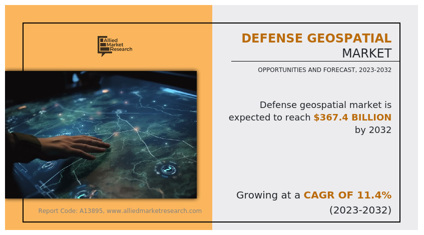
The global defense geospatial market size was valued at $126.4 billion in 2022, and is projected to reach $367.4 billion by 2032, growing at a CAGR of 11.4% from 2023 to 2032.
Report Key Highlights:
- The report covers a detailed analysis on the technology used in the defense industry.
- The market has been analyzed from the year 2022 till the year 2032.
- Latest developments have been mentioned in the research study.
- Top companies operating in the industry has been profiled in the research study.
- The research study includes different segments & regions across which the market has been analyzed.
Technologies which are used for geographic mapping and analysis of the earth’s surface and human societies are called geospatial technology. Satellites and other aerial objects are used for capturing the images of earth’s surface and human activities. Geospatial technology includes technology such as Geographic Information System (GIS), Remote Sensing (RS), and Global Positioning System (GPS).
A GIS is a system that is used for mapping and analyzing geospatial data and gives information about position of the objected on the surface of the earth. GIS is used for identify and detect geographic pattern in the data which helps to offer precise and accurate information about the geography of that location. Remote sensing (RS) technology offers data that is real time or near real time with the help of satellite and drones. The technology helps the defense services and intelligence agencies to monitor the national boundaries as well as provide situational awareness in the active operations. Global Positioning system (GPS) is widely used in surveying, mapping, aircrafts, marine ships, and vehicles. It is a system which operates on radio navigation and provides positioning information which is critical to the user.
The geospatial systems in defense help with the espionage, and offer situational awareness of an operation. The systems provide detailed information about the terrain, weather, and enemy location that helps the armed forces to execute the mission efficiently. The systems also provide simulation environment where the preparation and training of the operation can be conducted and different scenario can be tested. The best option or plan from all the scenarios can be selected for quick and successive execution. Geospatial technology in defense is expected to increase the reliability of the information which will increase the overall safety of the mission, and the armed forces, and increase the success rate of the mission.
The factors such as increase in the demand for reconnaissance and surveillance and increase in the integration of geospatial system with the other systems supplement the growth of the defense geospatial market. However, high cost and lack of accessibility and concern of data privacy and protection are the factors expected to hamper the growth of the market. In addition, focus on use of AR and VR in defense geospatial system through product innovation and AI combined with geospatial system creates market opportunities for the key players operating in the defense geospatial industry.

The global defense geospatial market is segmented into technology, type, and application. By technology, the market is divided into geographic information system (GIS), global positioning system (GPS), and remote sensing. By type, the market is categorized into surface analysis, network analysis, and geo visualization. On the basis of application, the market is classified into military logistics, intelligence gathering and battlefield management. By region, the market is analyzed across North America, Europe, Asia-Pacific and LAMEA.
The key players in global defense geospatial market research include Airbus, BlackSky, NV5 Global, Inc., Hexagon AB, Environmental Systems Research Institute, Inc. (ESRI), Trimble Inc., Maxar Technologies, MapLarge, Orbital Insight, and TerraGo.

Demand for Reconnaissance, and surveillance
The different tools and techniques used for the collection, analysis and interpretation of spatial data in relation with the man-made structures and earth’s surface is referred as Geospatial technology. Events such as Russia-Ukraine war created the demand for the reconnaissance and surveillance in defense geospatial operations. Nations around the world investing on defense and security system, due to the Russia-Ukraine war the security landscape around the globe becomes complex and volatile. The nations are developing and investing on systems that can offer accurate and timely intelligence.
Geospatial systems play significant role in military operations by providing accurate and precise information about the terrain, potential enemy threats and enemy activities within and beyond the national boundary of the nation.
For instance, team V-BAT (unarmed aerial system) of Shield.AI has collaborated with three other technical organizations, each of which provides highly specialized and experienced capabilities, to enable a very low-risk, non-developmental solution for the upcoming Royal Canadian Navy (RCN) Intelligence, Surveillance, Target Acquisition, and Reconnaissance (ISTAR) Project. In times of war, defense organizations are investing in advanced technologies and skilled personnel to meet the demand for reconnaissance and surveillance in defense geospatial operations. The reconnaissance and surveillance become a regular activity for the defense and research wing of a country. The amount of satellites and many other defense systems in the space collects data and offers insightful information, thus creating demand for the defense geospatial system and technology in the market.
Integration with other systems
The integration of geospatial systems into other defense systems has become increasingly important in modern military operations. Geospatial systems provide critical data and analysis that enhance situational awareness, decision making, and operational effectiveness across various defense domains. By integrating geospatial data from sensor feeds from satellites, drones, and other platforms, defense organization can gather real-time intelligence on enemy activities, monitor border and sensitive areas. Geospatial systems enable the fusion of data from multiple sources, and create accurate and comprehensive picture for the user. For instance, companies like Environmental Systems Research Institute, Inc. (ESRI) offer drone mapping software which allows the maps to be overlaid with other data sources, such as real-time data streams, photos, videos, and symbols, using geospatial mapping tools and geographic information systems (GIS). This integration empowers defense forces to achieve superior operational outcomes and maintain a competitive edge in modern warfare. The integration with different systems shows flexibility of technology and is expected to surge the demand in the market.

High Cost and lack of accessibility
The high cost and lack of accessibility present significant challenges for countries seeking to utilize geospatial systems in defense. The financial implication associated with geospatial technology can be daunting for nations with limited resources or constrained defense budgets. The establishment of geospatial system requires big investment in various dimensions such as infrastructure, employees, systems, software, and other equipment. It is difficult for many small countries with small economies to allocate sufficient funds to develop and successfully establish a geospatial program and system. Moreover, high cost is associated with procuring, establishing, and acquiring geospatial technology such as satellite imagery with skilled personnel which eventually hampers the growth of the market across the globe.
For instance, countries in Africa, such as Mali or Chad may struggle to allocate sufficient funds for acquiring and building assets which are required to develop the geospatial system and technology, for reference according to Artha’s report, by 2025 the geospatial economy of India would reach $7690 million. Developing countries may encounter difficulties in building a skilled workforce proficient in geospatial technologies. Overcoming the challenges requires targeted efforts, international cooperation, and support to address financial constraints, accessibility barriers, infrastructure limitation, and skills gap.

AI combined with geospatial system
Artificial intelligence (AI) is now present in almost every civilian industry. AI has changed the methods of operations of businesses and it is becoming a major element of the modern warfare. The integration of AI with the geospatial system can offer potential insights and accurate information in various sectors including agriculture, defense, transportation, and disaster management. Both AI and geospatial system are adept in analyzing large volume of data. AI can easily process and analyze large amount of data from satellite imagery, and aerial reconnaissance. It also helps detect, and identify pattern and anomalies. The information can be used for decision making.
Another valuable application of AI in defense geospatial systems is in the realm of predictive analytics. Defense organizations can gain predictive insights into areas such as weather patterns, or infrastructure vulnerabilities by training AI models on historical geospatial data and incorporating real-time inputs. AI-powered geospatial systems can also support autonomous or semi-autonomous operations in defense. For example, UAV equipped with AI algorithms can autonomously navigate and analyze geospatial data in real time, identifying potential target or providing intelligence support to ground forces.
The combination of AI with geospatial systems in defense holds immense potential for enhancing situational awareness, decision making, and operational capabilities.
Artificial intelligence is currently being used in every industry. It has changed the way people and organizations operate, and it is soon becoming an integral part of active battlefield and modern warfare. The practical aspect of AI with the numerous defense systems makes geospatial a lethal weapon and boosts the demand for geospatial technology in the defense sector. Moreover, AI combined with geospatial systems has the potential to transform a wider range of businesses and other sectors, such as defense, agriculture, disaster management, urban planning, and transportation which eventually leads to the growth of the defense geospatial market share across the globe.
The analysis of massive volumes of geospatial data is one area where AI and geospatial systems meet in defense. AI algorithms can process and analyze a wide range of geographic data sources, including satellite imagery, aerial reconnaissance, and sensor data, to discover patterns, detect abnormalities, and extract actionable insight. All the operational features of AI with the defense geospatial system are expected to surge the market growth in the present and future.
Key Developments
- In June 2022, BlackSky has entered into a contract with the United States Department of Defence (DoD). It is a five-year contract worth up to $241 million to build and optimise data sets for use in DoD AI models and applications.
- In April, 2023, National Reconnaissance office (NRO) signed a contract with the Maxar technologies. The contract allows Maxar technologies to demonstrate the real-world performance of its commercial RF network in support of US federal missions.
- In November, 2022, Maxar Technologies acquired Wovenware an AI and software engineering company. The acquisition of Wovenware is projected to improve and support Maxar projects spanning from UI design to full-stack delivery, resulting in new 3D terrain analytics tools, hundreds of ML training data sets, and dozens of automatic object detection models.
Key Benefits For Stakeholders
- This report provides a quantitative analysis of the market segments, current trends, estimations, and dynamics of the defense geospatial market analysis from 2022 to 2032 to identify the prevailing defense geospatial market opportunities.
- The market research is offered along with information related to key drivers, restraints, and opportunities.
- Porter's five forces analysis highlights the potency of buyers and suppliers to enable stakeholders make profit-oriented business decisions and strengthen their supplier-buyer network.
- In-depth analysis of the defense geospatial market segmentation assists to determine the prevailing market opportunities.
- Major countries in each region are mapped according to their revenue contribution to the global market.
- Market player positioning facilitates benchmarking and provides a clear understanding of the present position of the market players.
- The report includes the analysis of the regional as well as global defense geospatial market trends, key players, market segments, application areas, and market growth strategies.
Defense Geospatial Market Report Highlights
| Aspects | Details |
| Market Size By 2032 | USD 367.4 billion |
| Growth Rate | CAGR of 11.4% |
| Forecast period | 2022 - 2032 |
| Report Pages | 280 |
| By Technology |
|
| By Type |
|
| By Application |
|
| By Region |
|
| Key Market Players | Hexagon AB, BlackSky, Airbus, Orbital Insights, TerraGo, MapLarge, Esri, Trimble Inc., Maxar Technologies, NV5 Global, Inc. |
The key players analyzed in the report are, Airbus, BlackSky, Esri, Hexagon AB, MapLarge, Maxar Technologies, NV5 Global, Inc., Orbital Insights, TerraGo, Trimble Inc.
The global defense geospatial market was valued at $126,357.9 million in 2022, and is projected to reach $367,401.3 million by 2032, registering a CAGR of 11.4%.
North America is the largest regional market for Defense Geospatial
Intelligence Gathering is the leading application of Defense Geospatial Market
Global Positioning System (GPS) is the upcoming trends of Defense Geospatial Market in the world
Loading Table Of Content...
Loading Research Methodology...

