North America Remote Sensing Services Market Statistics: 2030
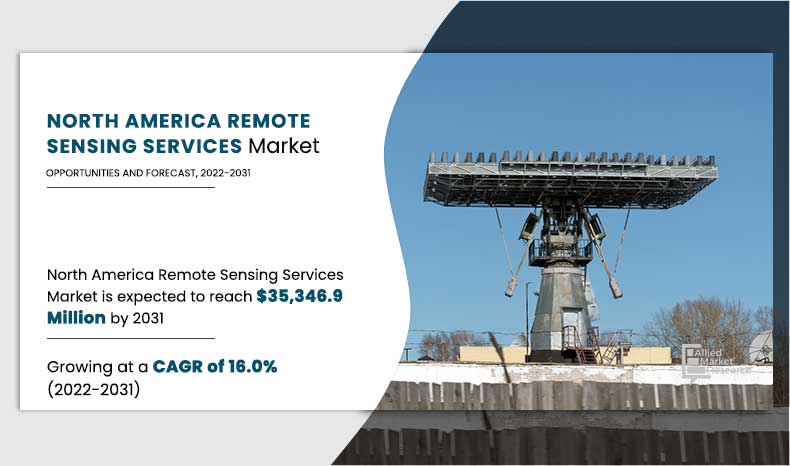
The global North America remote sensing services market was valued at $8,240.0 million in 2021, and is projected to reach $35,346.90 million by 2031, growing at a CAGR of 16.0% from 2022 to 2031.
Remote sensing technology is used for the process of acquiring information about properties of an area such as land, sea, and atmosphere with the help of remote sensing data provided by sensors located at some distance from the target. Its applications include weather forecasting, land-use mapping, study of natural hazards, environmental study, and resource exploration. Remote sensing practice can be done using devices such as various types of cameras placed on ground and in aircrafts, satellites, ships, or spacecrafts. Data obtained through remote sensing device is typically stored & manipulated by computers.
On the basis of platform, the ground segment dominated the North America remote sensing services market in 2021, and is expected to continue this trend during the forecast period. The ground based remote sensing techniques are cheaper and less labor intensive than alternative options of excavation, which provide lucrative opportunities for the market growth. Moreover, satellite remote sensing provides unique opportunities in offering various components of land information by integrating with ground-based observation, further drive the market growth. However, UAVs segment is expected the highest market growth in the upcoming years. Various governments including the government of the U.S. are making policies to push tribal communities into main stream public for their social and economic growth. Sometimes it is difficult for humans to reach into dense forest of tribal areas for surveying tribal communities, their forests, and farming lands. As a result, UAVs and drones are used for hassle free tasks. Such benefits drive the North America remote sensing services industry growth.
On the basis of end user, defense segment captured the largest market share in 2021 and is expected to continue this trend throughout the North America remote sensing services market forecast period. North America, rise has been witnessed in demand for remote sensing services, owing to decrease in cost of high-quality space-based remote sensing products and services with numerous opportunities for country or defense organizations to access space and remote sensing abilities. Furthermore, increase in such adoptions are expected to be opportunistic for remote sensing services in North America during the forecast period. However, the commercial segment is expected to witnesses the highest share in the upcoming years. The commercial remote sensing technology companies serve as flagships for the growing remote sensing industry in the U.S. commercial satellite imagery is raising the profile of remote sensing solutions to prospective governments and private-sector users. Furthermore, top enterprises are investing in commercial remote sensing technology, which is expected to provide numerous opportunities for the market growth in the North America.
By Platform
Ground segment is projected as one of the most significant segments.
Country wise, the U.S. is dominated the market share in 2021 for the North America remote sensing services market. Owing to robust remote sensing space industry can augment and potentially replace some existing U.S. government capabilities and can contribute to the U.S. military, intelligence, foreign policy, homeland security, and civil objectives, as well as U.S. economic competitiveness, which is expected to provide lucrative opportunities for the market growth in the upcoming year. However, the Canada is expected to exhibit highest growth during the forecast period. Remote sensing services play a vital role in development of natural resources in Canada for their discovery, regulation, production, development, and remediation, which drives North America remote sensing services market growth. In addition, rise in adoption of advance technology in Canada such as Earth Observation (EO) satellites, which help ECCC (Environment and Climate Change Canada) scientists to understand about water quality of lakes across Canada. Such advantageous drive the market growth in the Canada
The report focuses on the growth prospects, restraints, and North America remote sensing services market analysis. The study uses Porter’s five forces analysis to understand the impact of various factors such as bargaining power of suppliers, competitive intensity of competitors, the threat of new entrants, the threat of substitutes, and bargaining power of buyers on the North America remote sensing services market trends.
Segment Review
The North America remote sensing service market is segmented on the basis of platform, resolution, end user, and country. On the basis of platform, it is categorized into satellite, UAVs, manned aircraft, and ground. On the basis of resolution, it is classified into spatial, spectral, radiometric, and temporal. By end user, it is bifurcated into defense and commercial. Country wise, it is analyzed across the U.S. and Canada
By End User
Commercial segment is projected as one of the most lucrative segments.
.
Impact of COVID-19 on the North America remote sensing service trends
The global North America remote sensing services market was valued at $8,240.0 million in 2021, and is projected to reach $35,346.90 million by 2031, growing at a CAGR of 16.0% from 2022 to 2031. The COVID-19 outbreak has low impact on growth of the North America remote sensing service market as the outbreak of the COVID-19 pandemic has enabled the market to witness a sudden rise in 2020, owing to surge in adoption of remote sensing service and services by public health agencies, administrators, and policy makers to understand outbreak patterns in real-time as well as to identify at-risk populations and plan targeted intervention such as increase in healthcare capacities and evaluation of available facilities.
Moreover, businesses across the region are planning to come back stronger; hence, remote sensing and GIS service adoption would help them to map COVID-19 density zones to plan their business operations accordingly. For instance, in May 2020, Transerve Technologies, a provider of geospatial solutions launched a solution to map COVID-19 density zones using remote sensing and geospatial technologies. Solution provides accurate mapping of COVID-19 cases and containment zones as well as allows tracking, analyzing, monitoring, and visually representing geo-spatial data and helping organizations to take statistically driven smarter business decisions.
By Resolution
Temporal segment is projected as one of the most lucrative segments.
Top Impacting Factors
Factors such as increase in advancements in remote sensing technologies, rise in need of remote sensing data in various defense applications, growth in adoption of remote sensing services for environmental risk management, increase in investments in satellite communication and intelligence, surveillance, and reconnaissance (ISR) payloads, and use of satellite monitoring to control the spread of the COVID-19 are expected to impact the market growth. Emerging trends such as emergence of technologies such as cloud computing, big data analytics, and Internet of Things (IoT) are further expected to have a strong impact on the remote sensing service market in the upcoming years. However, regulatory issues and lack of comprehensive government policies and higher initial investments required for remote sensing hampers growth of the market. Thus, each of these factors is anticipated to have a definite impact on growth of the North America market in the future.
Rise in need for remote sensing data in defense
Adoption of robots, drones, and satellites, along with remote sensing capabilities have significantly improved the level of security of defense armed forces. Remote sensing data is increasingly used in defense applications for generation of geographic information for applications such as mission planning, flight simulation, and air-defense planning, which generates the need for adoption of remote sensing service in the defense industry. For instance, in January 2020, Kongsberg Geospatial, an Ottawa-based defense and aerospace geospatial technology company, and MartinUAV of Plano, Texas, a developer of UAV technologies, announced partnership to pursue an integrated intelligence, surveillance and reconnaissance (ISR) solution including remote sensing solutions for the Royal Canadian Navy and Canadian Special Operations Forces Command (CANSOFCOM), a defense organization. Remote sensing service solutions help such defense organizations across the globe in different applications to meet the growing need for remotely sensing data.
By Country
U.S. is projected as one of the most significant country
KEY BENEFITS FOR STAKEHOLDERS
- The study provides an in-depth analysis of the North America remote sensing services market share along with the current trends and future estimations to elucidate the imminent investment pockets.
- Information about key drivers, restraints, and opportunities and their impact analysis on the North America remote sensing services market size is provided.
- The Porter’s five forces analysis illustrates the potency of buyers and suppliers operating in the North America remote sensing services market.
- The quantitative analysis of the North America remote sensing services market share from 2021 to 2031 is provided to determine the market potential.
North America Remote Sensing Services Market Report Highlights
| Aspects | Details |
| By Platform |
|
| By End User |
|
| By Resolution |
|
| By Country |
|
| Key Market Players | SPECTIR, Radware Ltd., Lockheed Martin Corporation., Boeing Inc., MAXAR, The Airborne Sensing Corporation, THE SANBORN MAP, Terra Remote Sensing., Barracuda Network, Inc., Satellite Imaging Corporation, Key Market Players |
Analyst Review
According to CXOs of leading companies, in recent times, demand for geospatial data and advanced airborne, space-borne, and ground-based remote sensing data have increased in the region. Consequently, various government agencies, research institutes as well as private organizations are enormously utilizing remote sensing services to gather timely data. On the other hand, the trend of development of remote sensing is being transformed from panchromatic, hyper-spectral, and multi-spectral to ultra-spectral with an increase in spectral resolution. Although digital photogrammetry and GPS technology have improved the remote sensing process, there is still a significant amount of time and effort involved in data acquisition through remote sensing service. Ongoing developments of light detection and ranging (LIDAR) and laser terrain mapping systems for remote sensing is dramatically reducing time and efforts required for data acquisition.
Use of satellite imagery for forest monitoring is advancing tremendously since the past few years. This is leading to rise in adoption of remote sensing services for acquisition of datasets, which are produced by forest monitoring. These datasets enable international policy agreements that are associated with CO2 emissions in the atmosphere from deforestation and various types of changes in land-use. Moreover, in the COVID-19 pandemic, satellite-based monitoring applications of remote sensing service might be helpful to detect and control the spread of virus. High-quality geospatial data offered by remote sensing devices help to deliver statistical and dynamic models for setting-specific characterization of risk factors, disease transmission, and forecasts of pathogen prevalence.
Significant impacting factors of the market include increase in popularity of its applications in various fields of study such as geology, agriculture, land use planning, and geographic information system mapping (GIS). Due to its wide-ranging applications and capability to enable users to interpret, collect, and manipulate data from inaccessible locations, remote sensing service turned out to be a useful tool for researchers. In addition, innovations in this technology have major impact on the remote sensing service market growth.
The remote sensing service market is competitive and comprises a number of vendors competing based on factors such as cost, reliability, and quality of sensor image data and technical support services. Growth of the market is impacted by change in government policies about remote sensing and rapid advances in technology offerings, whereas the vendor performance is impacted by government support for commercialization of geospatial data, COVID-19 conditions, and industry development. Owing to the competition, vendors operating in the market are launching technologically efficient remote sensing services with an improved accuracy of sensor data.
Loading Table Of Content...


